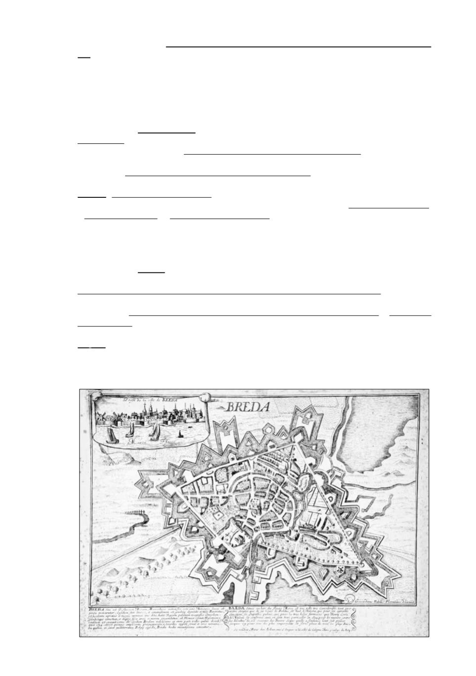
237
969 [Netherlands - Zype]
-
Afbeeldingh van de Zijpe, haar dykagie, wegen, wateringhen, molens
(...)
. “Opnieuw gemeeten en gekaarteert door Jan Dierckz Zoutman, geadmiteert Landmeeter uit
Alkmaar,” 1665, 45 x 66,5 cm, printed on 2 joined sheets, b/w. Good copy.
€
300/400
Interesting map of the polders of “De Zijpe” with decorative cart. showing landmen with cattle
and baskets of fruit, titlecart. with 2 putti. With coat-of-arms, compass rose, gattered people on the
shores and sailing ships.
970 [Netherlands]
-
3 optical prints
, various authors and sizes. Acceptable condition.
€
180/250
Middelbourg. Paris, Charpentier, end 18th c., orig. full col. in bright colors (3 tears invading the
pl. rep., compl. underlaid). - Vuë de la Porte des Zaag-Moolens à Amsterdam. Augsburg, Leizelt,
Collection des Prospects, c. 1775, 30 x 43 cm, full col. (waterstain, folds, some marg. foxing,
browning). - Le Canal qu’on appelle Kleveniers (...) Amsterdam. Augsburg, G.B. Probst, c. 1750,
30,5 x 41,5 cm, full col. (marg. soiling, marg. tears rep., fold, 2 tiny marg. holes).
We join
: Thof van Zeelandt. A. 1644. Engr. by B. Berkenrode after Z. Roman, Middelburg, 1644,
later reprint, 21,5 x 29,6 cm. (trimmed to border), mounted on laid paper. - t’ Raedhuys tot Tholen.
- St. Lievens Monster. - Zieric-zee aen de zee syde. From Smallegange’s,”Nieuwe Cronyk Van
Zeeland”, c. 1700, various sizes, b/w (St. Lievens Monster: splitt. c’fold rep., Zierik-zee: printed on
2 joined sheets, trimmed to border, part of sky lacking clumsily repaired). (7 pcs)
971 [Netherlands]
-
3 maps
, Amsterdam, F. de Wit, c. 1680-1725. In all acceptable condition.
€
120/200
Corectissima nec non novissima Dominii et Provinciae Groningae et Omlandiae (...). Ex officina I.
Covens et C. Mortier, c. 1725, 49,5 x 58,2 cm, outline col. (waterstains, soiled & frayed edges, splitt.
c’fold rep.). - Ducatus Geldriae et Comitatus Zutphaniae, tabula auctore F. de Wit. - Ultraiectini
Dominii tabula. 2 maps c. 1680, 46,52 x 54,9/57 cm, cities shown in red (splitt. c’folds +/-18 cm &
marg. tears underlaid, marg. rep., waterstains).
We
join
: Nieuwe kaart van het Westelykste (- Oostelykste) gedeelt van Staats-Vlaanderen. Amst. Is.
Tirion, 1747, 33,3 x 74 cm, 2 maps printed on 2 sheets joined together, orig. col. (some minor marg.
foxing). Good copy. Nice map with Vlissingen, Zuid-Beveland, Markgraafschap Bergen-op-Zoom,
Antwerp, Hulst, Axel, Bruges etc. (4 maps)
968


