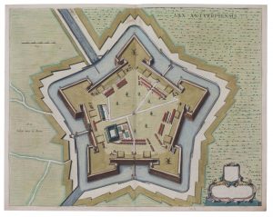
(BRABANT) — Un lot varié de topographie des XVIIe et XVIIIe siècles: – 1. une carte coloriées aux limites de Bruxelles, Louvain et Anvers, titrée 'Le Brabant Espagnol qui comprend les Quartiers de Brusselles De Louvain', par Nicolas Sanson,...
Description
■ (BRABANT) — A varied lot of 17th to 18th century topography:
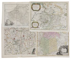
1. a border–coloured map of Brussels, Louvain and Antwerp, titled 'Le Brabant Espagnol qui comprend les Quartiers de Brusselles De Louvain', by Nicolas Sanson, publisched by Hubert Jaillot, 1674. 440 x 575 mm
2. a border–coloured map of the region between Mechelen and Brussels, titled 'Pars Meridionalis Brabantiae continens dominium Mechliniense Ducatum Arschotanum' by Frederik De Wit, ca. 1681–1700. 460 x 545 mm
3. a coloured map, titled 'Ducatus Brabantiae nova Tabula' published in Johan–Baptist Homann's 'Atlas maior', ca. 1740. 585 x 485 mm
4. an engraved map of the Low Countries, titled 'A new & correct map of the Netherlands or Low Countries' published by Eman Bowen, 1752. 355 x 430 mm
Tot. : 4 ex.
DESCRIPTION NL.
■ (BRABANT) — Een gevarieerd lot 17de–18de–eeuwse topografie:
1. een grensgekleurde kaart van Brussel, Leuven en Antwerpen, getiteld 'Le Brabant Espagnol qui comprend les Quartiers de Brusselles De Louvain', door Nicolas Sanson, uitgegeven door Hubert Jaillot, 1674. 440 x 575 mm
2. een grensgekleurde kaart van het gebied tussen Mechelen en Brussel, getiteld 'Pars Meridionalis Brabantiae continens dominium Mechliniense Ducatum Arschotanum' door Frederik De Wit, ca. 1681–1700. 460 x 545 mm
3. een ingekleurde kaart, getiteld 'Ducatus Brabantiae nova Tabula' uitgegeven in de 'Atlas maior' van Johan–Baptist Homann, ca. 1740. 585 x 485 mm
4. een gegraveerde kaart van de Lage Landen, getiteld 'A new & correct map of the Netherlands or Low Countries' uitgegeven door Eman Bowen, 1752. 355 x 430 mm
Tot. : 4 ex.


