


 64 / 174

Cartografie
179 – (Globe) -
SEUTTER, Matthias.- Sphaerae artificiales [...].
[Augsbourg, Matthias Seutter, c. 1730].
Gravure sur cuivre, 50,5 x 58,5 cm + grandes marges, rehaussée à l’aquarelle (fixée par les coins sup.).
Sous passe-partout.
Est.
:
600/ 800 €
Importante planche joliment rehaussée figurant une paire de grands globes (terrestre et cé-
leste) et une sphère armillaire suivant Ptolémée. Par Matthias Seutter (1678-1757), l’un des
plus importants et des plus prolifiques éditeurs cartographiques allemands du 18
e
siècle.
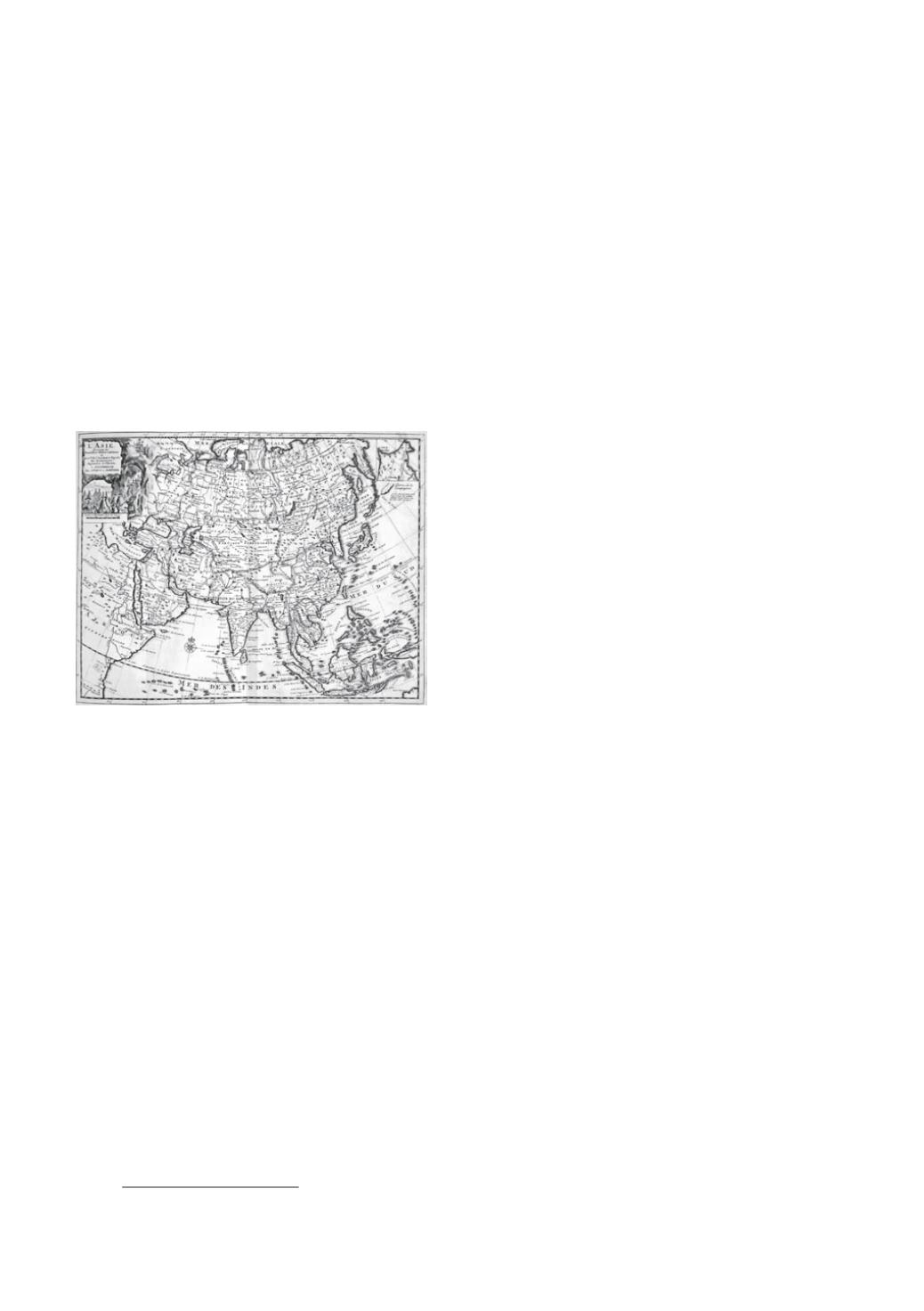
180 – (Atlas) -
COVENS, Joannes; MORTIER, Cornelis.- Nouvel atlas, très-exact
et fort commode pour toutes sortes de personnes, contenant les principales
cartes géographiques. Dressé suivant les nouvelles observations [...].
Amsterdam, Covens & Mortier, [c. 1730].
Pet. in-f° oblong : titre et table gravés, 6-6 pp., 101 pl.,
frontières rehaussées (plis au centre des pl.).
Rel. de l’époque : demi-veau à coins, plats de papier
moucheté, dos à nerfs titré doré (plats frottés, mors
fatigués, pet. manques aux coiffes).
Est.
:
2.500/ 3.000 €
Atlas mondial contenant : le titre et la table
gravés,- une description des 4 continents
en français et en néerlandais (2 x 6 pp. de
texte),- 4 planches (globes céleste et terrestre,
rose des vents et sphère armillaire, globe céleste,
mappemonde en deux hémisphères),- 97 cartes
avec frontières rehaussées. Troisième édition par
Covens et Mortier de cet atlas que Pieter van der Aa fit paraître en 1714.
# Koeman C&M 13 (mentionne erronément 98 cartes).
¶ World atlas by Covens and Mortier with the plates as in the 1714-edition by van der Aa. Contains :
engraved title and index, 4 plates (with different globes, a celestial and a world map) and 97 maps.
Contemporary half calf.
181 –
[ORTELIUS, Abraham].- Parergon, sive Veteris geographiae aliquot
tabulae [...].
[Antwerpen, Jan Baptist Vrients, 1609].
In-f° : engraved title, 40 pl. mounted and heightened (4 introductory text lvs with laudatory poems lacking,
some small foxing, very small tear in the lower margin of title-page restored, central folds of 5 pl. reinforced
in lower margins, small crack in paper in the lower margin of 1 pl., handwritten numbers on text lvs and small
note in the margin of 1 text lf.).
Modern binding by Sangorski & Sutcliffe, London : red oasis, upper board decorated with central gilt ornament,
ribbed spine with gilt title (small marks of use).
Est.
:
7.000/ 9.000 €
Complete collection of maps
devoted to the antique and biblical world by Ortelius
(1527-1598), the second part of the 1609-Latin edition of his “Theatrum Orbis Terrarum”
(1
st
edition : 1570) which was the first large modern atlas and a landmark in the history
of cartography. Without the introductory text but complete with an engraved title and
40 fine coloured plates : 35 maps, 2 plates figuring the orders of the Holy Roman Empire, a
view of the Escurial and 2 imaginary subjects (“Daphne” and “Tempe”). All on double pages
with Latin text on verso. With a handwritten index.
# van der Krogt 31:054.